
DRONE SURVEYOR
Reva Drones offers a monthly fixed wireless internet monitoring service for wireless internet providers.

Our service includes the monitoring of emerging physical barriers (e.g., trees) as well as dynamic future growth predictions and local network interference surveillance to determine causes of slowdowns and outages.
We use a custom drone payload and proprietary in-house software allows to gain insights that will minimize internet problems while being affordable for any wireless internet service provider.
OUR NEW PODCAST:

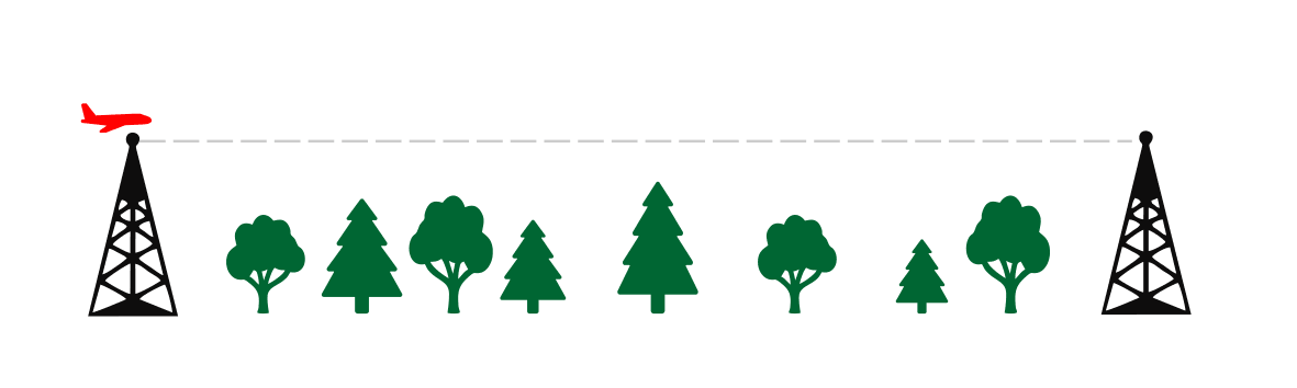
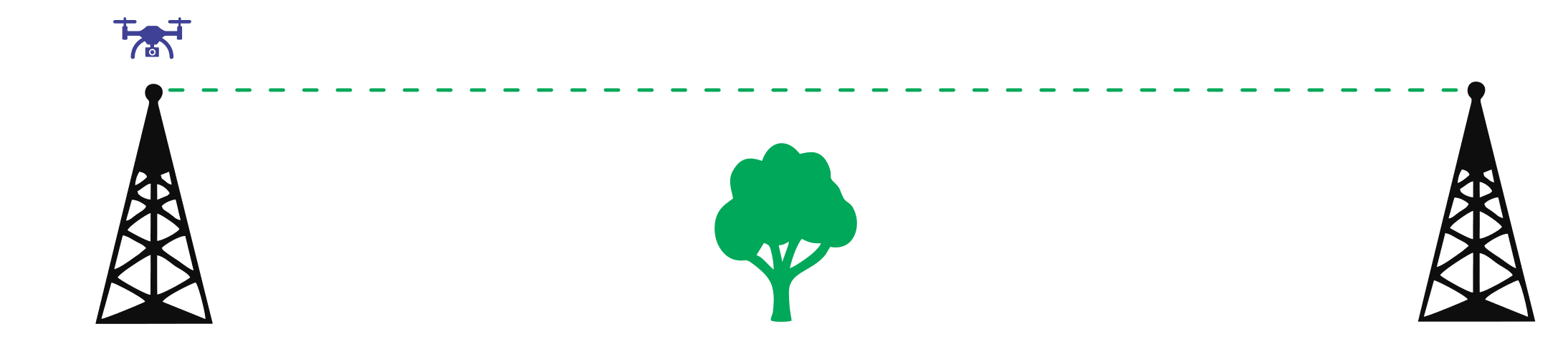
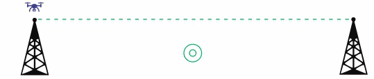


Physical signal barrier analysis allows Reva Drones to identify current barriers and predict how tree canopy growth will impact the connection in the near future. Network interference surveillance using our custom spectrum analyzer gives Reva Drones the ability to analyze sources of slowdowns and failures due to frequency use by other devices in the vicinity of the subscriber. more
01


02
FLEET
Reva Drones uses the Albatross UAV, which can fly for up to four hours, has an MTOW (maximum takeoff weight) of 10kg, and is flexible enough to carry the necessary equipment, making it perfect for physical signal barrier monitoring and local network interference surveillance between transmitting towers and end-user receivers.
With the help of an integrated laser altimeter, this fixed-wing drone is completely self-contained from takeoff until landing. It is capable of being operated beyond visual line of sight (BVLOS) with the pilot still being able to take full control of the drone as needed.
Our payload includes a modern LiDAR capable of measuring up to 120m, a spectrum analyzer we designed and built in-house that uses a Raspberry Pi4 for data processing, a camera, and required navigation equipment as recommended by the drone manufacturer (Applied Aeronautics). more
03
Reva Drones monitors emerging physical obstructions (e.g., trees), provides dynamic new growth predictions, and conducts local network interference surveillance to detect the causes of slowdowns and failures. We utilize a custom drone payload and proprietary in-house software to collect insights that will help wireless internet service providers solve challenges while being cost-effective.
DRONE NETWORK SURVEILLANCE
BENEFITS
WE MAKE INSPECTION AUTOMATED AND EASY
BIRD'S-EYE VIEW
Reva Drones see what cannot be seen from the ground and can identify signal interference on-location at the transmitter and receivers. Predicts physical signal barrier growth and future connectivity impediments
MONITORING ANYWHERE
Fixed-wing drones can access locations that are difficult to traverse for humans and vehicles, especially during seasons when roads may become unusable.
Able to access remote rural areas with ease.
SAVE TIME AND MONEY
Timely forecasting of potential physical barriers and the accurate identification of network frequency interference saves time and money by minimizing downtime, reducing slowdowns, and making troubleshooting easier.
